


Volcanic coast
Madeira is basically a series of cliffs surrounded by ocean, and they’re all different colours. I was flying from about a kilometre away, just moving the drone slowly over the edge to see what was there. It was windy, but nothing the Mini 4 Pro couldn’t handle.
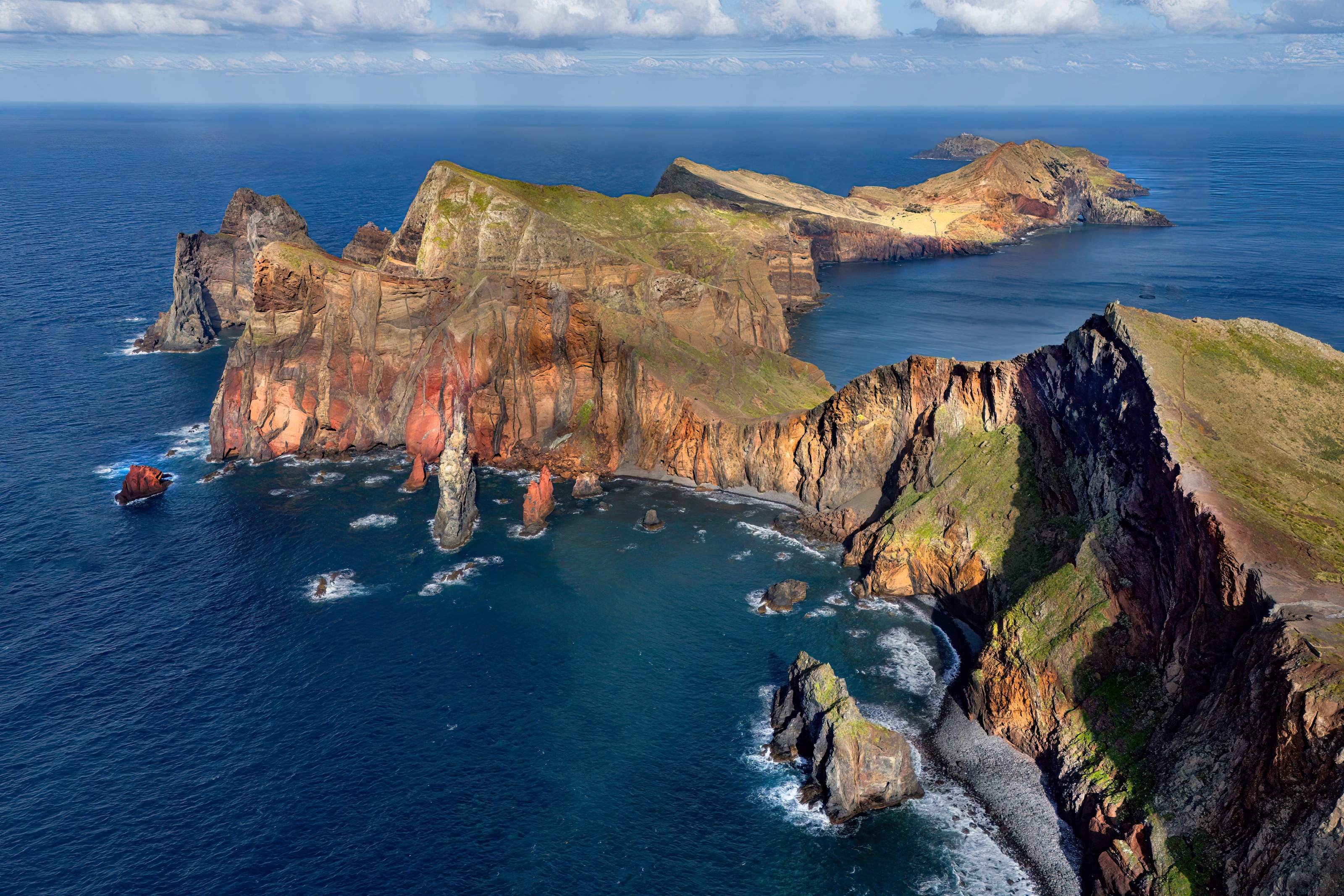

Ponta de São Lourenço
Ponta de São Lourenço is the easternmost peninsula of Madeira, known for its volcanic landscape and the sharp contrast with the surrounding water. The terrain here is exposed and largely treeless due to the strong northern winds, giving it an atmosphere often described as “the edge of the world.”
I did a 6-7 km round-trip hike with views of both the north and south coasts. I’m not used to hiking in places without trees, which made it feel quite different from what I’m used to.
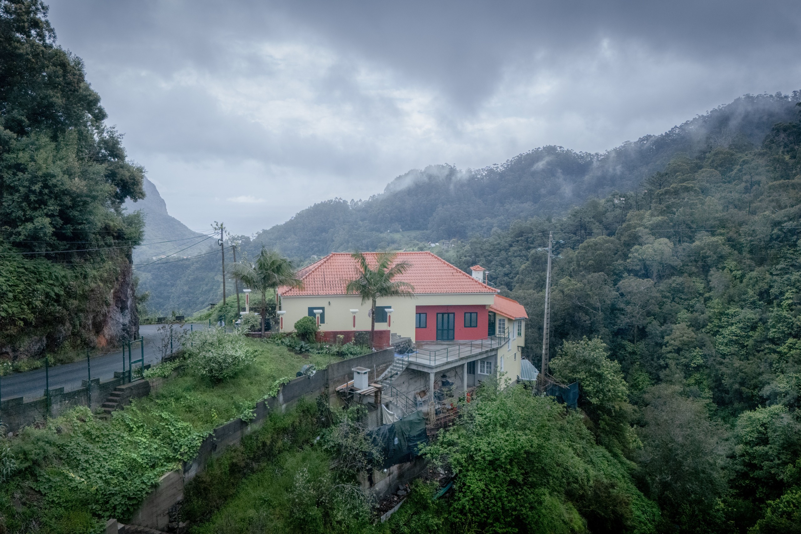

On the ledge
A good amount of effort went into this place, probably. The terrace cut into the slope, retained, planted, stabilized, and slowly brought into shape. Someone looked at this slope and decided: yes, this is where I’ll live.
From the drone, that decision makes sense. From the ground, it feels a bit improbable. The view from that garden is likely exceptional, easily enough to justify everything that went into it.


Serra de Água
A valley that funnels straight back into the mountains. The village follows the road, which follows the river, which follows the only flat ground available. The legendary asphalt car rallies take place across the island’s steep and narrow winding roads. And I got a chance to see that while I was here. Cars moving at high speed, taking tight turns, with the engine noise echoing through the valley.


North shore
The north coast road runs along a stretch where the Atlantic meets the island with full force. A sea wall separates the water from the road, with the cliff rising immediately behind — and on rough days, the spray reaches across all of it. Just before breaking, the water is deep turquoise, then turns white as it hits. Behind the road, the terraced hillside climbs steeply, with banana plants occupying nearly every available patch of land.


The coast road
This was my favourite stretch. I drove along the coast five to six times, stopping every time without really planning to. I always ended up coming back to this stretch in the evenings.
It had rained in the mountains in the morning, but by the time I reached the coast the weather had turned mild and pleasant. The light kept shifting between grey and warm as I drove along.
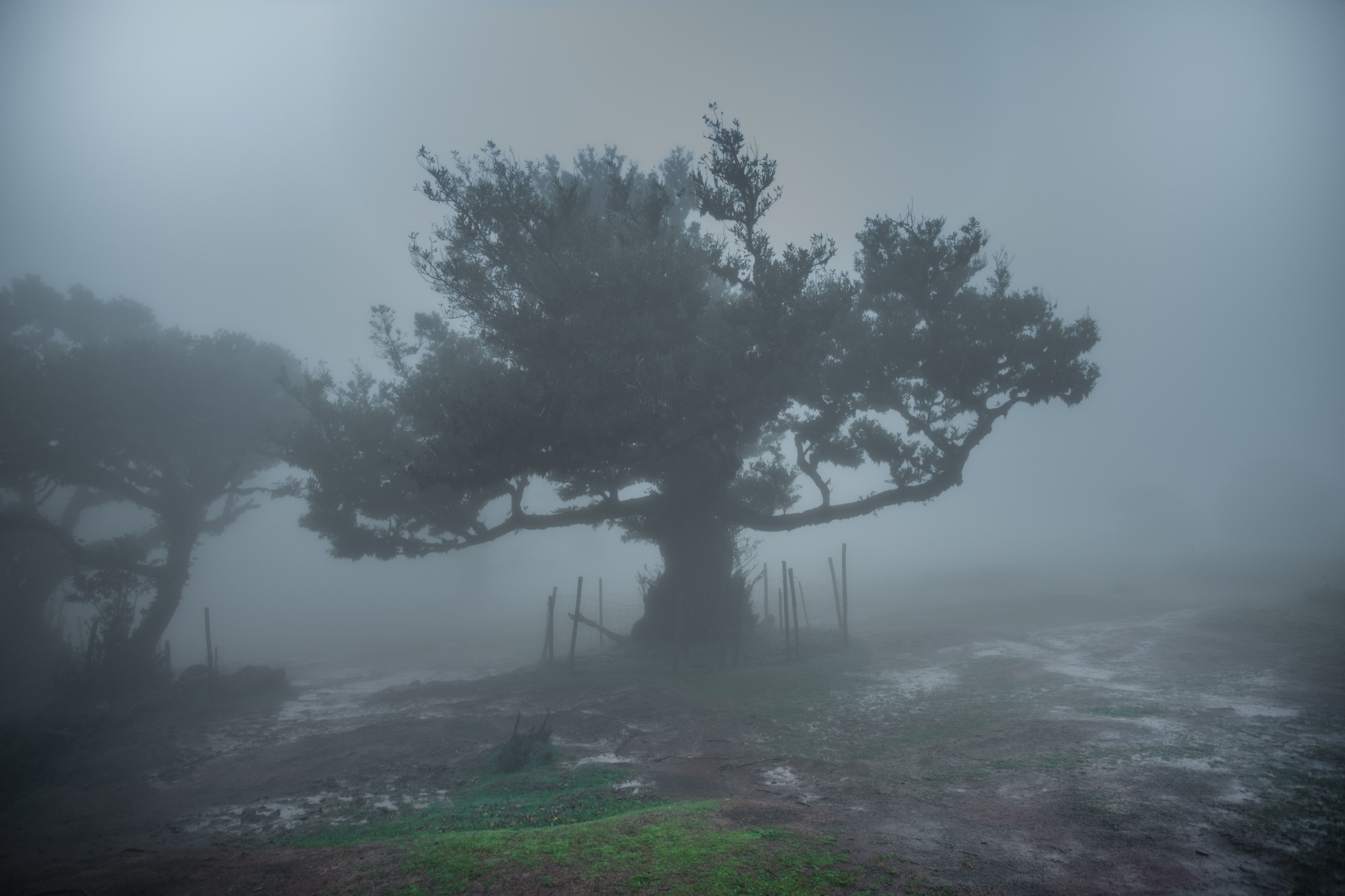

Fanal
Fanal is a plateau in the Laurissilva forest at around 1200 metres and it’s almost always in cloud. The trees there are ancient, hundreds of years old, with thick trunks and branches that spread wide and low. I reached around 6 a.m. with rain, fog, and barely any light. Third attempt, and this time it finally looked like what I’d been coming for.
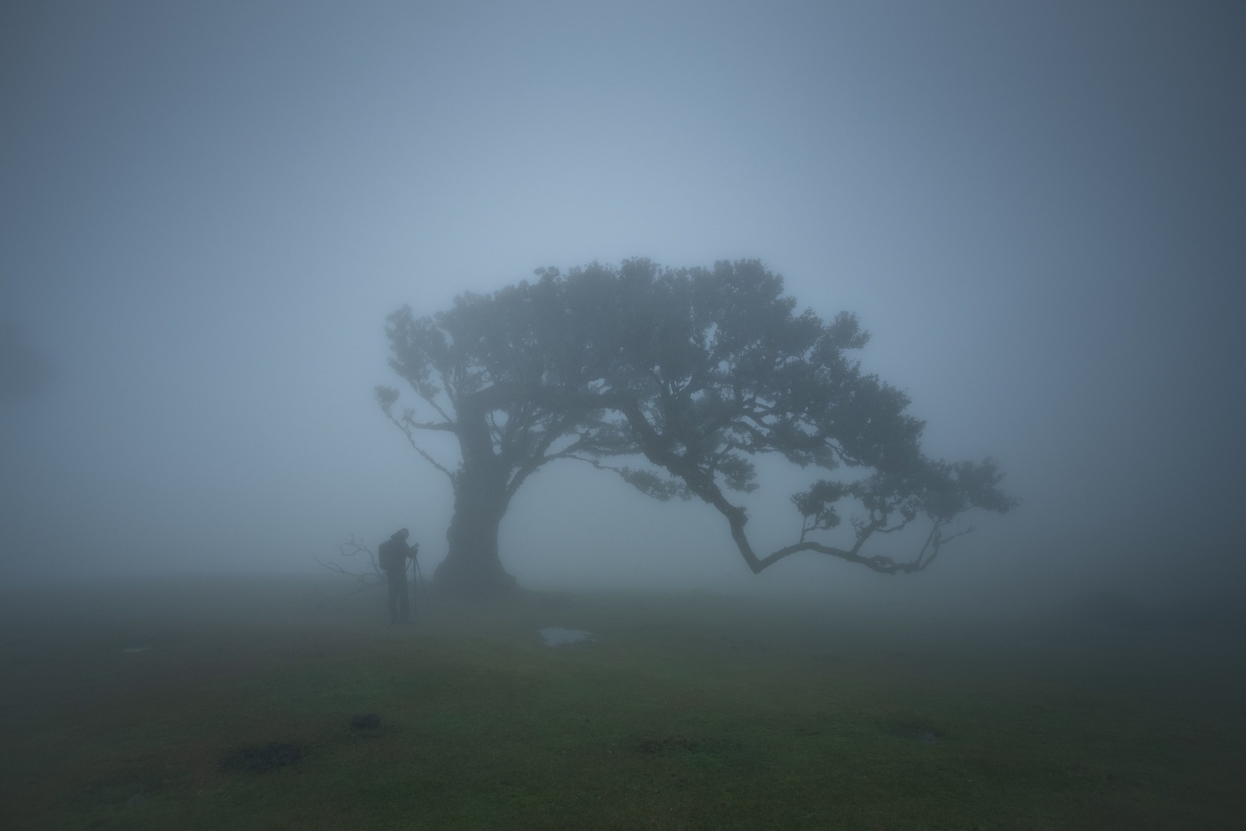

The tree
The fog was so dense I could barely see twenty metres. Nothing looked normal and that was the beauty of it. I saw someone standing under a tree with a tripod, completely still, working on a portrait. And honestly, shots like these don’t come quickly. They take time, patience, and a lot of waiting around. Which tree do you pick when there are 60 that all look worth it?


Above the clouds
The mountain road cuts across the highland plateau, shot straight from above. The clouds sit exactly at that altitude, so the frame is split in two: land below, white nothing above. While I was flying, my drone then decided that the cloud was an obstacle and refused to proceed. Had to wait around a min before I could get control.